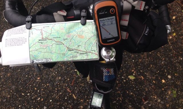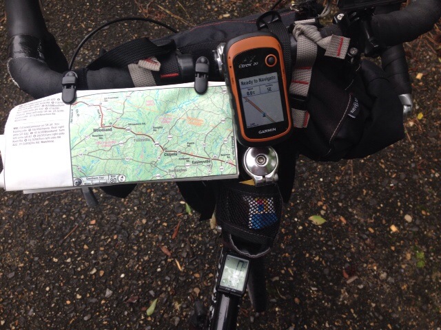
I use Adventure Cycling Route Maps, a Garmin Etrex 20 GPS and a cycle computer to help with navigation and to ensure that I always know where I am.
The ACA map is attached to my handle bar with cue sheet clips that are available at many bike shops. The GPS is attached to the handlebar stem and the cycle computer is attached to the bike top tube.

I use the map to determine where to go and what turns to make. Distances between key features are indicated in red on the map.
The GPS is set to a screen that shows me my location and the names of upcoming roads and highways. I use the Garmin Etrex 20 because it uses AA batteries. I carry a charger and 4 rechargeable batteries with me. Once charged, two AA batteries will keep the unit powered for several days. With 4 batteries I don’t have to worry about running low if I’m camped at locations without power. The maps that come with unit aren’t sufficient for touring so I purchased the Garmin North America City Navigator micro sd card and have maps, lodging, restaurants, and other information available for me while on the road.
I use the cycle computer to track my mileage between key features and match lines that are indicated on the map.
This system works well for me. I don’t like to rely solely on the maps because sometimes map names and the names posted on road signs don’t match up. I don’t like to rely on the GPS alone because I may not always be in a location at night where I can charge the batteries and believe it or not, electronics can fail.
The Adventure Cycling Route Maps provide cyclists with the necessary details to support you as ride across the country. The text below comes from the ACA website.
Service Symbols
Symbols correspond with the service information on the text side of the map, and tell bicyclists what sort of services they will encounter along the route such as campgrounds, bike shops, grocery stores, libraries, restaurants, post offices, hostels, motels, cyclists-only lodging, bed and breakfasts, and hotels.
Bi-directional Narratives
Narratives have detailed turn-by-turn instructions for traveling in either direction. The number preceding each directive indicates the distance you’ve come since the beginning of the map panel at the matchline. (The number following in parentheses is the distance in kilometers.) Changes in road names and numbers are marked by stars both in the narrative and on the map panel.
Elevation Profiles
Elevation profiles indicate major ascents and descents. On the Lewis & Clark Trail maps, the profile is attached to each map panel. On other maps, in the mountainous regions of the country, the profile appears in one continuous panel on the text side of the map. (Note: Not all map sections have elevation profiles.)
North Arrow
The north arrow is not necessarily up as it is on most maps, and it changes orientation from panel to panel. This allows as many miles of the route as possible to be depicted on each map panel, which helps us keep down map production costs.
Matchlines
Matchlines are solid pink lines on each end of the map panel intersecting the route. The narrative leads you from matchline to matchline. Once you “reach” the matchline, turn to the next map panel and begin following its narrative, again proceeding from the near matchline to the far matchline.
Distances
Given in miles and kilometers.
Field Notes
Details about the natural history and cultural heritage along the route
Weather Chart
Provides average monthly rainfall and mean temperatures at various points along the route
Detail Maps
Provide large scale view of urban or congested areas
Riding Conditions
Summary information regarding road surfaces, traffic volumes, and areas of caution.
For more information about the ACA maps visit the Adventure Cycling website.
